
Ross Lake Lithium Project
The Ross Lake Lithium Project is a single claim situated approximately 70 kilometres east-northeast of Yellowknife and 25 kilometres away from the Hidden Lake Lithium Project (Loyal Lithium ASX:LLI). The claim is surrounded by the South Slave/North Slave Land withdrawal with one live claim to the north covering the now closed Peg Tantalum Mine which operated in the 1940s (Figure 1).
The Ross Lake Lithium Project area was first examined between 1944 and 1955 by the Geological Survey of Canada (GSC) who carried out an extensive study of the zoning of pegmatites in the region around the Ross Lake Lithium Project (Figure 1).
Importantly, spodumene has been documented in a significant pegmatite within the project, ‘Dyke #No. 75’ (Figure 2) is mapped for over 150m of strike with extensions of the pegmatite prospective along strike. It contains spodumene perthite + quartz +/- plagioclase +/- muscovite in its core which is around 10m wide at surface.
Recent details of Trinex exploration activities on the project can be found in the following ASX announcements:
- 20 February 2024: Spodumene Confirmed at Ross Lake and MAC Lithium Project Update
- 8 January 2024: High Grade Lithium Confirmed at Ross Lake
- 27 September 2023: Transformational lithium acquisition in Canada
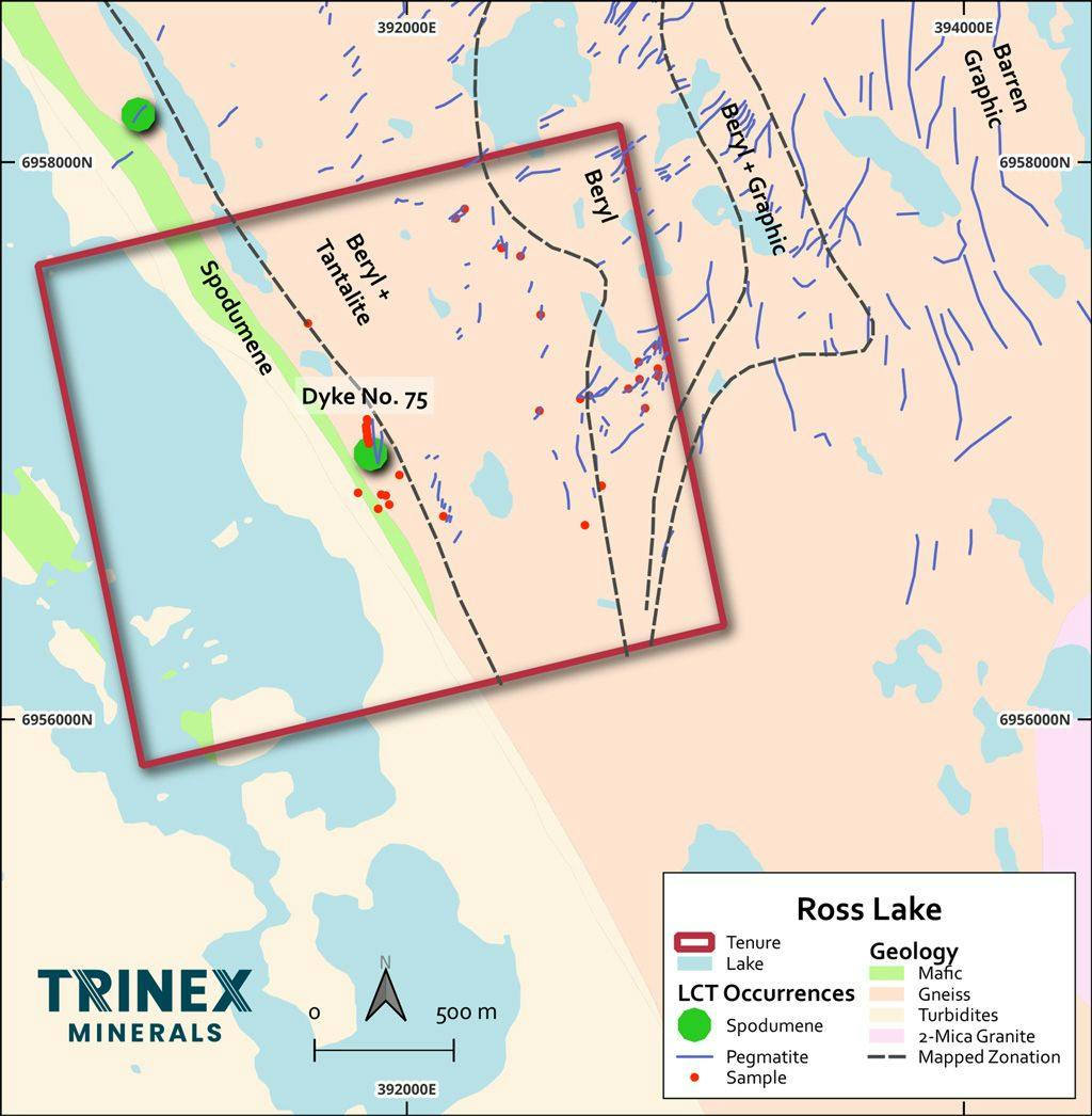
Figure 1 – Ross Lake Lithium Project showing the location of the spodumene bearing pegmatites in and adjacent to the claim, the classical LCT pegmatite zonation and the location of the historical Peg Tantalum Mine.
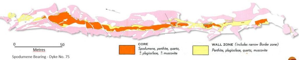
Figure 2 – Detailed mapping by GSC of ‘Dyke No. #75’ showing the spodumene core in red and wall rock alteration in yellow. The dyke is up to 15m wide at surface.